NAK Property
About NAK
The NAK Project lies within the Babine copper-gold porphyry district of central British Columbia. It has excellent infrastructure through all-season roads and is close to the towns of Smithers, Houston, and Burns Lake, B.C., which lie along a major rail line and Provincial Highway 16. Historical drilling and geophysical, geological, and geochemical work at NAK, which began in the 1960's, revealed compelling near surface porphyry copper and gold mineralization, but subdued metal prices and difficult access resulted in the project seeing no significant work between 1996 and 2022, when American Eagle Gold assumed ownership of the property. Since 2022, over 60,000 m have been drilled, greatly expanding upon the historically delineiated mineralization, discovering discrete high-grade zones enveloped by very a broad mineralization footprint, now extending over 1.5 x 1.7 km. The tenor and scale of mineralization at NAK sets it apart from its peers in the district, with abundant bornite, chalcocite, and chalcopyrite encountered from surface to depths greater than 800 m. The results of American Eagle Gold's drilling at NAK have attracted numerous large investments from major mining companies Teck and South 32, as well as a recent strategic investment by Eric Sprott. American Eagle Gold is now focused on rapidly advancing discovery at NAK, with an anticipated 50,000 m and year round drilling planned for 2026, and a view to formal resource definition and PEA studies at the conclusion of the 2026-2027 drill season.
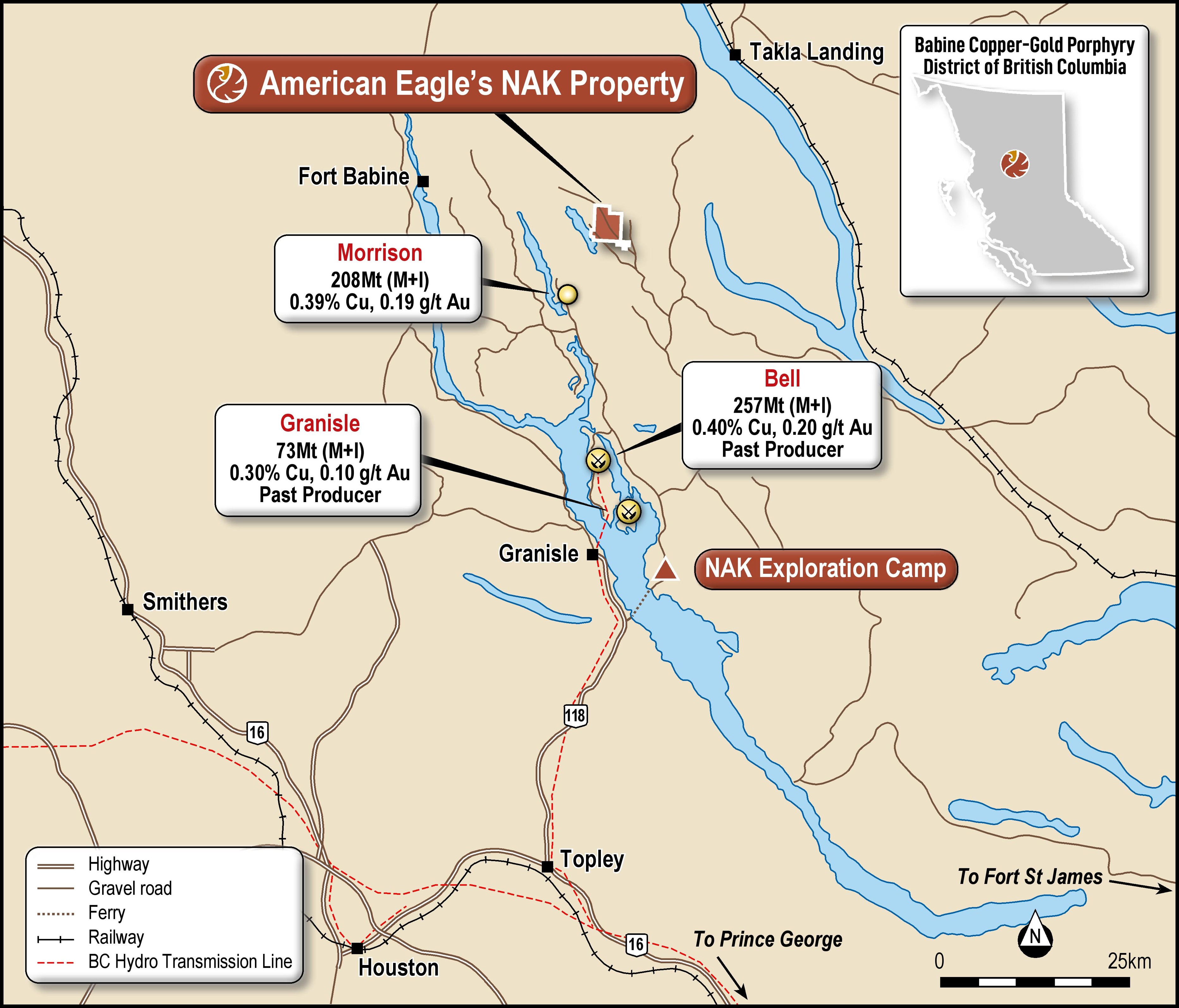
Proven Economics in a Mineralized Belt: The NAK Property lies within the Babine Porphyry belt of Central British Columbia. The Babine Porphyry Belt is characterized by Eocene aged granodiorite to diorite intrusions that are known to host economic concentrations of copper and gold. Significant deposits in the region include the past producing Bell and Granisle mines, the Morrison deposit with a defined mineral resource, and the exploration stage Duke deposit.
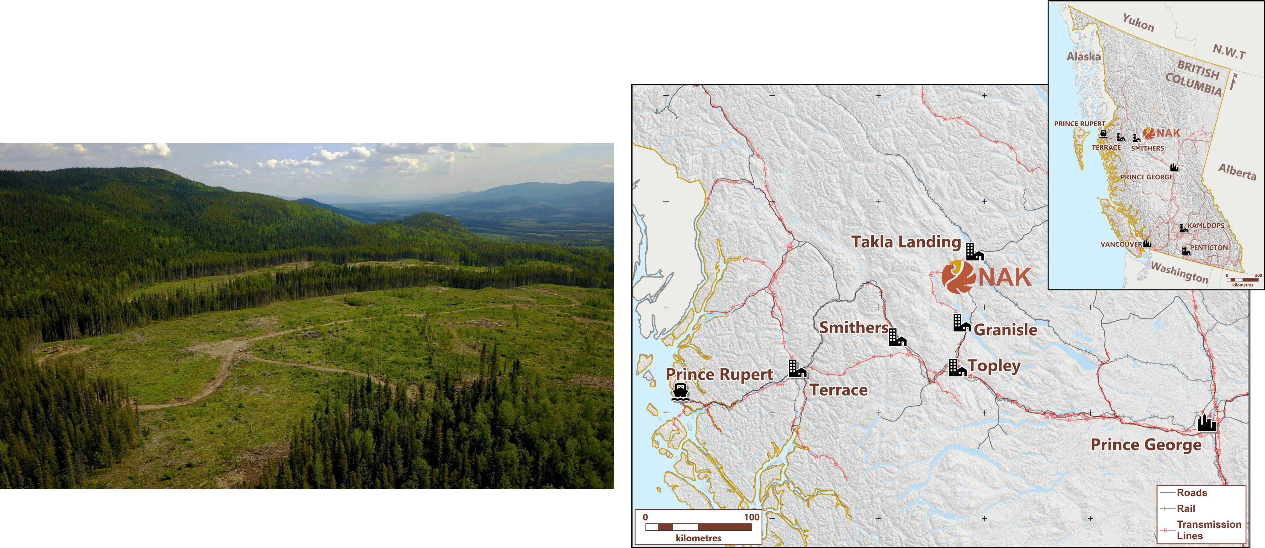
World Class Development Potential: The NAK property is characterized by low relief terrain, low elevation, and remarkably easy access. Logging roads pass directly through the property, and large clearcuts exist over the currently delineated best mineralized zones. An extensive network of historical exploration trail, coupled with low to moderate winter snowfall amounts allow for year-round drilling accessed primarily by skid-mounted drill rigs.
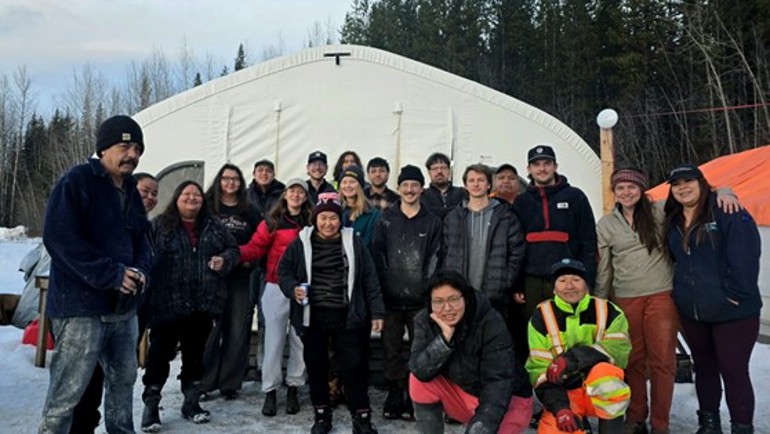
Strong Community Engagement and First Nations Support: The NAK property is located entirely within Lake Babine Nation Traditional Territory. Since 2022, American Eagle Gold has worked closely with LBN partners, and remains committed to continuous consultation and engagement as the NAK project advances.
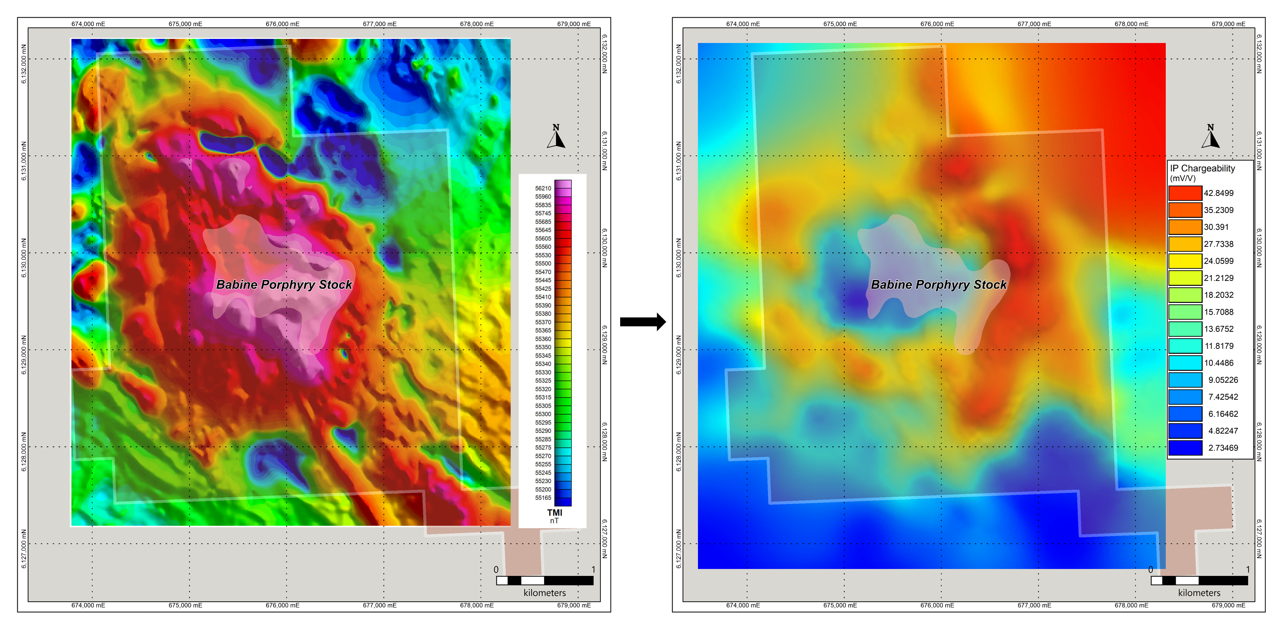
Classic Porphyry Geophysical Signature: The NAK Property hosts a central porphyry intrusion with a strong coincident magnetic high, flanked by a broad Induced Polarization chargeability halo. Similar geophysical expressions exist at Bell, Granisle, and Morrison, but lack the considerable scale and continuity of NAK
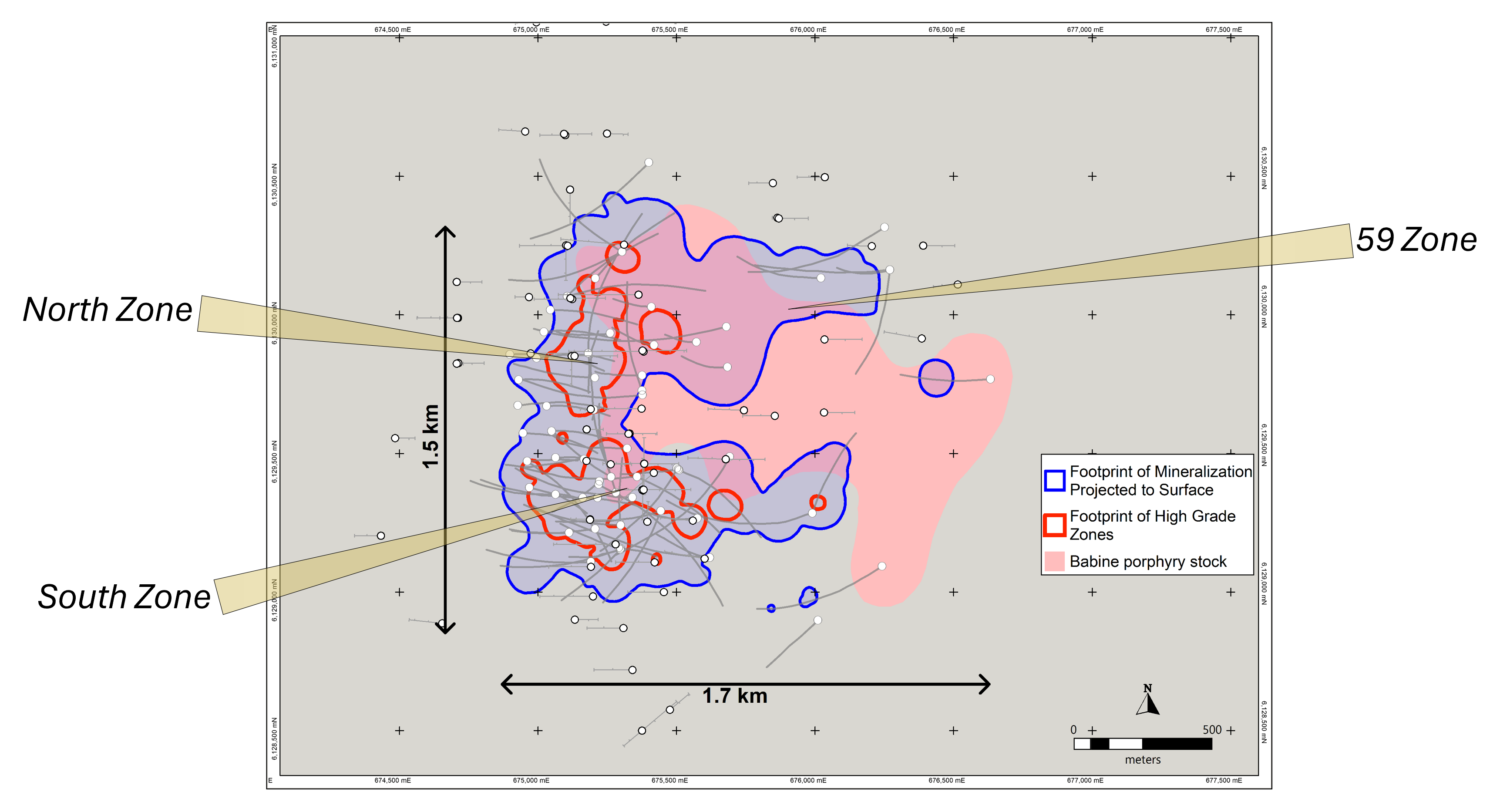
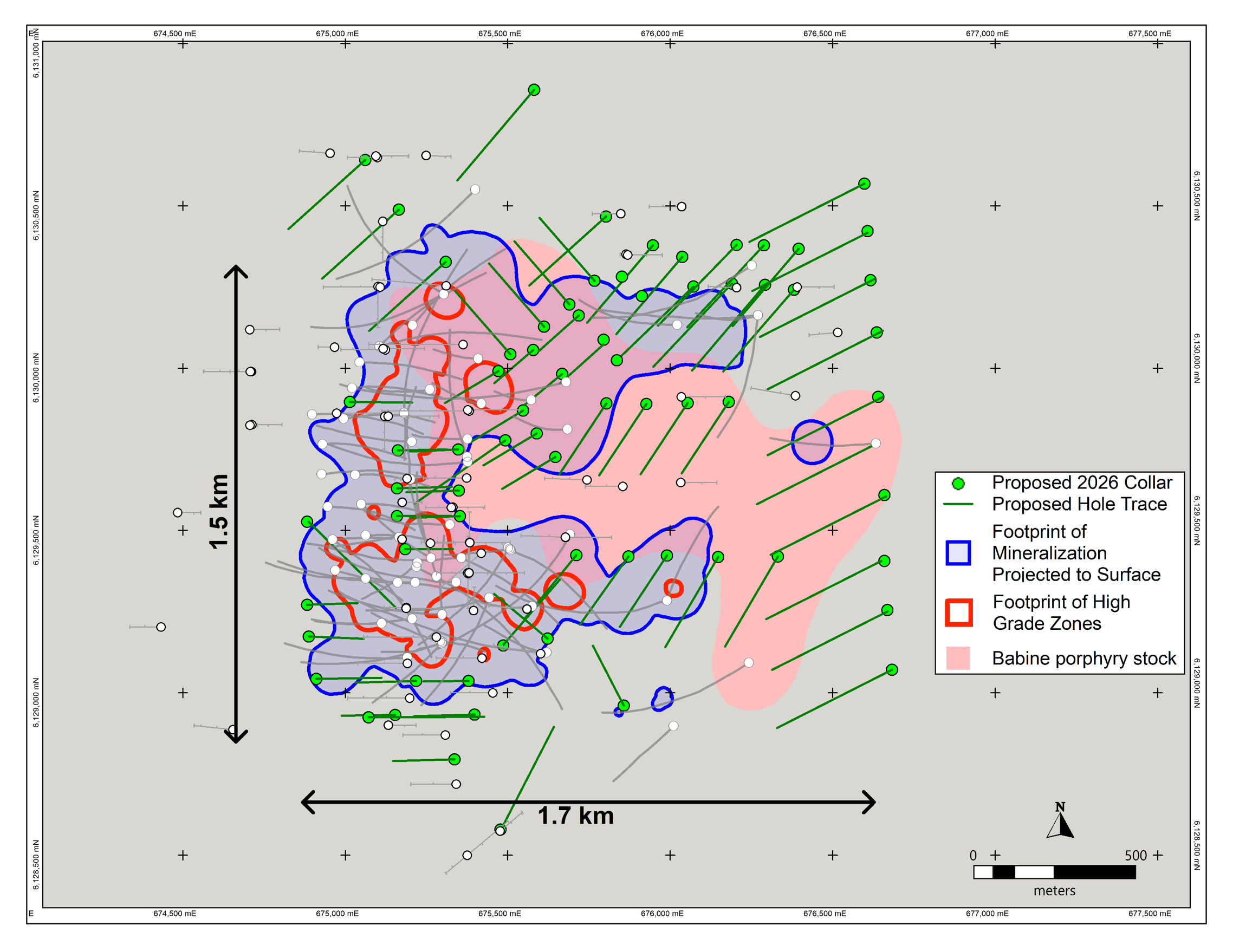
Scale and Grade: Since 2022, American Eagle gold has drilled over 60,000 m, and has significantly expanded upon the historically outlined mineralization footprint. Additional zones of high-grade mineralization, at surface and at depth, have been outlined within a broader mineralization envelope now extending over 1.5 km in the north-south direction, and up to 1.7 km in the east-west direction.
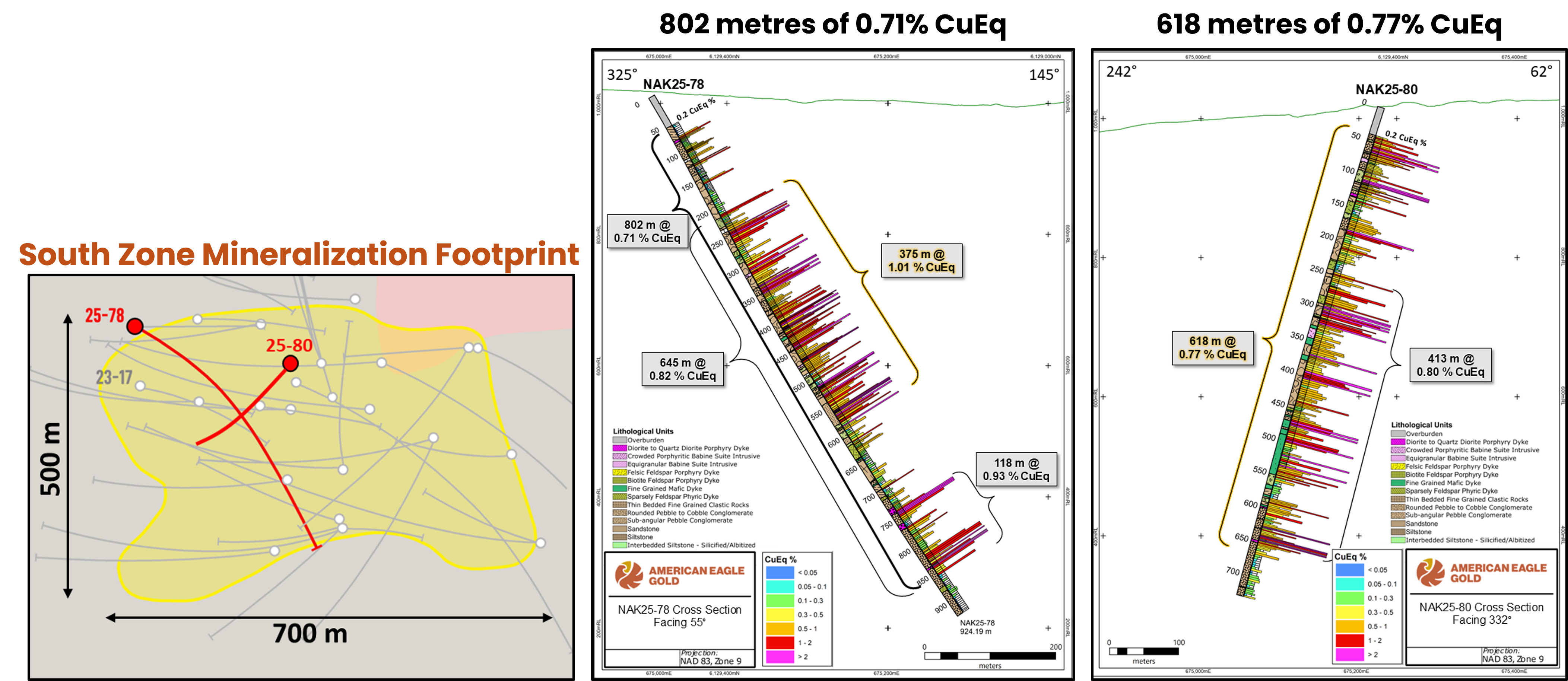
Exceptional Grade over Broad Widths: The South Zone, beginning at surface represents a compelling starter pit opportunity, extending strong copper and gold grades to a depth of over 800 m.
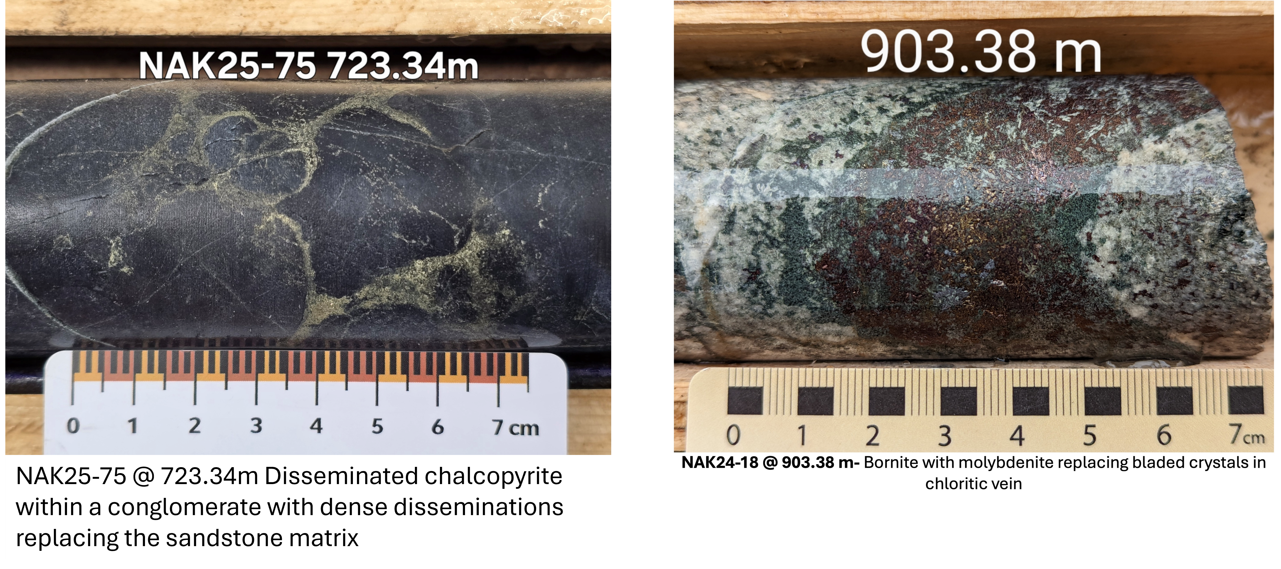
Mineralization – Lithological and Structural Control: Excellent tenor of mineralization, with abundant bornite and chalcopyrite. Mineralization within porphyry stock is interpreted to exploit a consistent structural fabric associated with later-stage mineralized dyking. Significant mineralization in bounding host rocks exploits the porosity in conglomerate and sandstone lithologies.
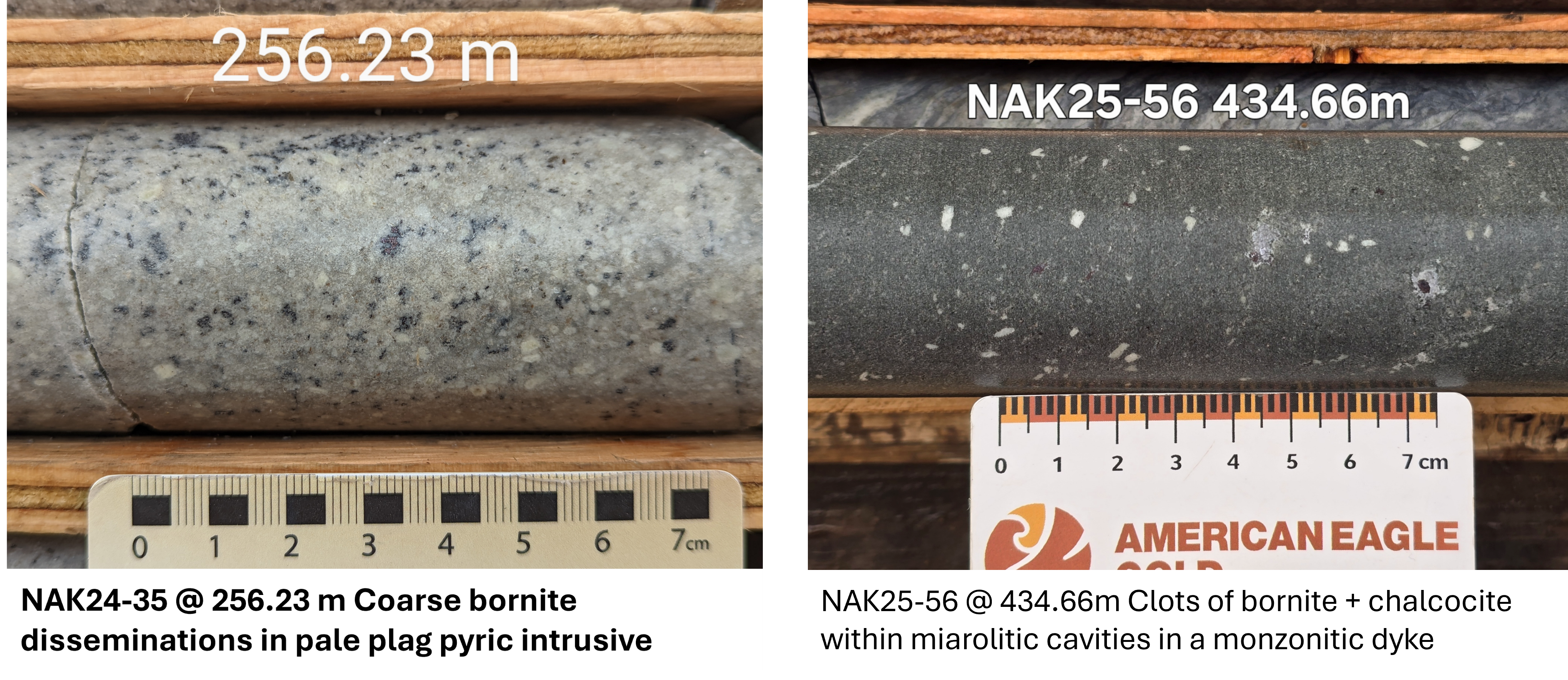
Dyking – Priming and Enrichment Spanning Multiple Mineralizing Events: Zones of strongest mineralization appear to be driven by multi-phase dyking. Early phase of mafic to intermediate intrusions which pre-date the porphyry stock appear to prime the host rock with sulfide nucleation sites. Later stage felsic dykes which post-date the porphyry stock are associated with strong bornite and chalcocite mineralization.
Fully Funded with Strategic Backers: Teck, South 32, Eric Sprott, and OreGroup collectively own more than 53 % of American Eagle Gold, based on the strong results and exceptional exploration potential at NAK. ~$55M Treasury with highly streamlined management significantly de-risks NAK in comparison with peers
Robust Plan for Discovery: Fully funded for over 3 years of operation, the 2026 season will allow the full scale of the NAK system to be drilled and defined before the Company focuses efforts towards resource definition and feasibility studies in the latter half of 2027
NAK Technical Webinar - Steve Garwin
NAK Copper Project: Expert Analysis Webinar by Renowend Geologist Steve Garwin - Watch here
NAK Project - Technical Presentation
Copper Equivalent Calculation
Disclosure: Copper Equivalent (CuEq) for drill intersections is calculated based on US$ 4.50/lb Cu, US$ 3,375/oz Au, US$ 60/oz Ag and US$ 25/lb Mo, with 80% metallurgical recoveries assumed for all metals* The formula is: CuEq % = Cu % + (1.10 x Au g/t) + (0.0196 x Ag g/t) + (0.00056 x Mo ppm).
*Since it’s unclear what metals will be the principal products, assuming different recoveries is premature at this stage. As such an 80% recovery rate is justified at this point in time.